Space Foundation News
Panel Talks about Redefining Disaster Management
Written by: developer
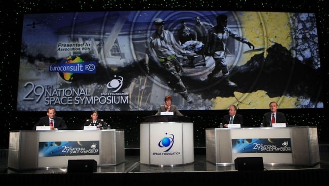
 Concentrating on the valuable role satellites play in disaster communications, the Space and Satcom - Redefining Disaster Management panel on April 9 was moderated by Susan J. Irwin, president, Euroconsult USA Inc. (pictured, left) and comprised:
- MAJ Linda Bozada, USA, chief, Theater SATCOM plans & programs, United States Pacific Command
- William (Bill) G. Connelly, vice president and general manager, ViaSat
- Matthew J. Desch, chief executive officer, Iridium Communications
- Jeffrey R. Tarr, chief executive officer, DigitalGlobe
Highlights
 Connelly (pictured, right) said that satellite communications are no longer the communications link of last resort because it is becoming increasingly portable while also improving capacity and speed. "Even in non-disaster situations, typical terrestrial communications cannot always be relied on," he said.
 Desch (pictured, left) noted that satellite communications can be provided for a variety of purpose, including such things as first responder communications, radiation monitoring helicopters and warning buoys. "We provide the network, but the solutions come from the users," he said.
 Tarr (pictured, right) said that his company had responded to three disasters worldwide in just the past week. "Disaster management is not about charging customers, but about helping those in need as best we can," he said. He also talked about collaboration, saying, "The walls come down in disaster situations where people and companies cooperate, driven by the desire to help."
 Bozada (pictured, left) noted that technical and leadership education and training are critical in developing nations to allow them to become effective first responders.
The panelists discussed innovations, including employment of additional spectra, such as infrared, to penetrate smoke from fires and innovations that address increased traffic.
They also discussed a wide variety of disaster services, including:
- Providing images to volunteers who can identify damages in disaster-stricken areas.
- Producing predictive analytics to improve disaster response.
- Providing imagery for battlefield assessment of where assets need to be deployed most.
See More
See video of the session here.
See photos here.
Related Articles