Transcripts
What You Missed On The Vector Episode 12: “Celebrating 50 Years of GPS”
Written by: Morsiell Dormu
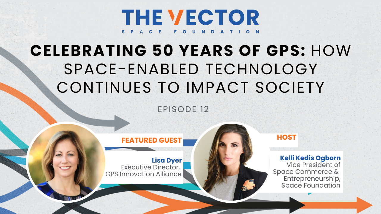
In this engaging episode of The Vector, Kelli Kedis Ogborn, Vice President of Space Commerce & Entrepreneurship at the Space Foundation, celebrates the 50th anniversary of GPS with Lisa Dyer, Executive Director of the GPS Innovation Alliance. With over 25 years of experience at the intersection of public policy, national security, and technology, Lisa provides insights into GPS’s history, evolution, and enduring impact on society.
Highlights include Lisa’s insights on:
- The Origins of GPS: GPS emerged as a joint initiative to unify navigation systems across the Department of Defense, driven by national security needs and operational efficiencies. Collaboration between engineers, policymakers, and program managers played a crucial role in its success.
- Multifaceted Applications of GPS: Beyond navigation, GPS underpins critical sectors including emergency response, precision agriculture, power grid management, and financial systems. Its applications extend to supporting the visually impaired and aiding in disaster recovery.
- Economic and Societal Impact: GPS has contributed $1.7 trillion to the U.S. economy and supports over 6.5 billion devices globally, with expectations to grow to 10 billion by 2030. Lisa highlights its role in improving efficiency and sustainability in industries ranging from transportation to public safety.
- Key Policy Decisions: Decisions like President Reagan’s move to make civil GPS signals publicly available and President Clinton’s ending of selective availability catalyzed commercial innovation, enabling applications like precision farming and autonomous vehicles.
- Securing GPS for the Future: Addressing challenges like GPS spoofing and jamming, Lisa emphasizes the need for modernization and enhanced anti-jam capabilities. Current GPS satellites already offer significant improvements, and future technologies will bolster resilience and precision.
- Global Leadership and Competition: Maintaining U.S. leadership in positioning, navigation, and timing (PNT) technologies is critical amidst rising competition from global systems. Lisa stresses the importance of investing in innovation and infrastructure to ensure GPS’s role in national security and economic growth.
- Vision for the Future: GPS will continue to enable smarter cities, efficient resource use, and global connectivity. Exciting advancements include using GPS for lunar navigation and enhancing sustainability in space operations.
This episode honors GPS’s legacy while envisioning its transformative potential for the next 50 years. Lisa’s insights underscore the importance of global collaboration, policy support, and innovation in sustaining GPS’s critical role in modern society.
Stay connected with the Vector Community! Visit us here to sign up for the Vector Newsletter for quarterly updates, news, and stories, or opt into monthly updates about The Vector Podcast, featuring thought leaders in space, entrepreneurship, and innovation. You can even suggest topics or speakers for the podcast. Don’t miss out—subscribe today!
Episode Transcript
Kelli Kedis Ogborn:
Hello everyone, and welcome to the Vector where we discuss topics, trends, and insights driving the global space ecosystem. I am your host Kelli Kedis Ogborn, and I’m thrilled to be joined today by Lisa Dyer, who is the executive director of the GPS Innovation Alliance. Lisa has more than 25 years of experience as a leader at the intersection of public policy, national security, business and technology. As a graduate of the Air Force Academy, she began her career serving at Los Angeles Air Force Base at Wright Pat. And after transitioning from the military, her career spanned both public and private sector as well as both US coasts. While living in San Francisco, she worked at a startup and a nonprofit focused on responsible uses of ai. And while in DC she spent more than a decade working on space and technology policy issues at the Department of State. Welcome, Lisa.
Lisa Dyer:
Thank you so much, Kelli. It’s a pleasure to be here.
Kelli Kedis Ogborn:
Absolutely. Well, I am so excited about this conversation because GPS turned 50, which such an accomplishment.
I also think it’s a really important conversation to have because everybody uses GPS, right? Everybody interacts with it. And really it could be said that it is one of these integral backbone technologies that prop up systems and services all around the globe that many people probably don’t realize or take for granted. And so I’m really interested to get your perspective to learn about where it came from, where it’s going, and all the good stuff in between. So to start by painting the picture, can we start at the beginning? So really, how did GPS get formed? What is the history? What is the origin? Who are the players? I mean, who really brought this revolutionary technology to the world?
Lisa Dyer:
That’s a great question. There are so many people across the United States from academia, from federally funded research and development corporations to engineers that just and program managers who made this possible. There are actually two really great articles. I’d love to steer your listeners to get a flavor for just what went into making GPS possible today. There are two GPS world articles from May and June of 2010 aptly titled Heroes
That lay out the names and the personalities of the folks who were involved in just what role they played from the time before GPS was funded by the Department of Defense to the years afterwards that were just so instrumental in making it possible. The second article that I would steer your listeners to is an Air Force Institute of Technology article. It’s a 2007 study on the engineering aspects of GPS and the Joint program office, what it did to pull all of these disparate systems and technologies together, some of them quite leading edge, some off the shelf, to make it a reality. These two articles really compliment each other to give you a good sense of the history and the people involved. I would love to point out two things that stood out as I was reading those articles, and one is how much we have Sputnik to think for GPS two to think for a lot of things we do, don’t we?
Yeah. Two really great engineers at Johns Hopkins applied Physics laboratory took a look at the signals and they, I’m greatly oversimplifying this, of course, but looking at the Doppler shift that came from those signals and then reversing it, putting it on the earth, they realized you can figure out a location of where you are on that earth. And thanks to those signals and those engineers, GPS has contributed 1.7 trillion to the US economy and counting, and it is employed hundreds of thousands of people in the United States and even more across the globe thanks to all of the different technologies that has spun up. The technologies you referred to at the start of this podcast.
Kelli Kedis Ogborn:
What’s really interesting about the Sputnik origin is s Sputnik was a moment of reckoning for the US in a lot of ways. We have modern day space industry because of our space waste with Russia, DARPA was created from it. A lot of these agencies was GPS created more because they saw the potential of a capability, or was it national security focused or maybe a mixture of both?
Lisa Dyer:
It was a lot of things. What I have read through the AIT article and other history sources of history is that the secretaries of defense who were looking at a potential system like GPS were really concerned about the proliferation of navigation technologies across the Department of Defense. Each service was developing its own capability, and so they said it really makes a lot more sense financially, systems wise, working together wise to put it into one particular program. And one of the major decisions that was made at the time that they decided to select a design for the architecture as well as to fund the development was to create a joint program office. Actually, when I started at Los Angeles Air Force Base in 1994, the G-P-S-J-P-O, as it was called and known as was flying High, they had just completed initial operational capability for GPS, and it was the place to be. The excitement was palatable,
And the engineering expertise and the program management expertise was so valued and so well felt throughout that program and across Los Angeles Air Force Base. And I think that’s one of the secrets to GPS’s success is that you had people who, the military folks, you had people going back to the program many times throughout their careers. You had them going to different programs at Los Angeles Air Force Base and bringing that expertise back to GPS and what they learned in GPS back to. So I’d say the G-P-S-J-P-O is one of the secrets to its success.
Kelli Kedis Ogborn:
That’s a great point. And I love how you painted that. It was also very multidisciplinary. Can you really start to paint a lot of those different segmentations, a lot of the different areas that people engage with GPS that some they may know and some may surprise them?
Lisa Dyer:
Absolutely. Let me first talk about the lesser known services that GPS enables. In order to figure out where a satellite is located, GPS, you want to do precision satellite formation, flying GPS, and then the atomic clocks that are on their synchronize so many different aspects of our economy, our banking transactions, the signals that are transmitted through our telecoms networks, electric substations, power plant generators. You’re able to identify power outages more quickly, water leaks through the water utilities.
Kelli Kedis Ogborn:
Oh, interesting.
Lisa Dyer:
Incredible. It also supports precise navigation for the visually impaired, which is really important if you are visually impaired, knowing where you’re going and where to turn and where to stop. That’s incredibly important information that gives you the confidence to be out in the world. Emergency response first responders, actually more than 80% of 9 1 1 calls are placed from wireless devices. So the GPS signals mixed with wifi nearby helps send those signals to the nearest nine one one call center, and then they can dispatch the first responders to get there. In off-grid emergencies, people carry devices like this little thing, and they can push the button, connects them, takes their location generated from a GPS sensor and connects it to a call center to say, Hey, I’ve broken my leg. I’ve fallen in a goalie. I need help. Can you get someone to me? It’s used to monitor the subsidence of dams to look for indications that dams may fail in earthquakes, GPS and seismometers pinpoint precise locations and get that information out to the public.
Oh, wow. Precision agriculture farmers can use just the right amount of water, just the right amount of seeds, just the right amount of pesticides to maximize the yields from their farming. And the military’s uses of it are long and storied, and I could go on and on and on GPS and geographic information systems helping us better navigate and better understand where we are in this world. And as you mentioned, Uber Eats, my nephew drove for Uber Eats between years in college on his summer breaks, and that was how he got the food to his customers as soon as possible. And that made a difference on how many customers he could have, the tips and his pay. So huge, huge applications all across.
Kelli Kedis Ogborn:
I didn’t realize that from the, you’re talking about the water leaks and the gas leaks or even some of the agriculture applications. I knew that satellite data was obviously utilized, but mainly from the remote sensing aspect to be able to talk about droughts and fires and agricultural yields. But I did not know that GPS was implicated in those industries.
Lisa Dyer:
Yeah, absolutely. And it really is. I mean, you think about the food insecurity that’s taking place across the world, the conflicts that are ruining farmlands, farmlands that are no longer usable because of unexploded ordinance. So really thinking smartly about how we apply technology to agriculture, I think is a huge part of our future as we continue to help feed the world.
Kelli Kedis Ogborn:
Absolutely. I think it’s the role of the space industry and space ecosystem surely to be able to make sure that as we’re pushing toward more systems and more complicated systems, that there is a direct terrestrial application to benefit life on earth. And a lot of the industries and ecosystems that are the underpinning of our development here that can definitely benefit from these advances.
Lisa Dyer:
Oh yeah, absolutely. Absolutely. And I think what’s really exciting is that the GPS industry has really thrived and innovated and came up with new applications that no one could think of. And I think there are two really big policy decisions that made that possible. That says, to me, policy is extraordinarily important in this conversation as well as the engineering, as well as the program management. I mean, first of all, after a Korean airline unknowingly flew into Soviet airspace and was shot down, president Reagan made the decision that the civil signals would be made free and available to the civil community. And those civil signals are what the GPS community, the industry uses to develop all these applications we just talked about. And then President Clinton’s decision to end selective availability that really allowed GPS to offer more precise applications of technologies such as precision agriculture and some augmentation systems are allowing UAVs to fly. It will be an important part of autonomous driving to make sure that cars are staying where they are, that they’re not merging into each other. GPS isn’t enacting alone in a lot of those situations. The really beautiful thing about GPS is it works well with others. So other space-based sensors, other sensors embedded into different types of technologies, but it brings something unique that other sensors don’t bring to this conversation.
Kelli Kedis Ogborn:
And when you talk about the community, and really you painted this picture of everything from tech development to policy to government agencies, and then also to your point, the integration into other systems. So who is part of this community? If you could just give me broad strokes about buckets or different examples, I think it would help our viewers really understand who we’re talking about.
Lisa Dyer:
Absolutely. I take a very broad brush approach to the GPS community definition. I have been so fortunate since I started this job to have former bosses from the Air Force, former colleagues from my Air Force time, from my government time people I’ve known for years who have been willing to give me their time and share their expertise around how did GPS come about, where are some opportunities and challenges that we can look to make sure GPS is available for the next 50 years?
And I would say that I’ve met some incredibly wonderful new people who are on the civil community side of the house, whether in the government or outside the government. I’ve met folks from the airline industry who are absolutely passionate about the importance of GPS to be available because GPS is an important part of aircraft navigation, whether you’re doing general aviation or whether the airlines are using it, it is a public safety aspect of it. Spectrum experts. Interesting. Yeah, the users of these systems and how it’s working for them and how it’s not, I hear from people who are vexed when they feel like their GPS didn’t give ’em the best directions. Those are the people that we need to keep involved in the community and keep their voices involved. People from the geography community, they’ve been fantastic in talking through the complimentary aspects of geography and GPS. So I put almost every single representatives from almost every single industry in that bucket of the GPS community as a result of all of the different applications that it
Kelli Kedis Ogborn:
Has. It’s definitely multidimensional, multifaceted, multi impact right across all these different communities. And you said something really poignant, which I want to pull on a little bit. So you mentioned this enabling and making sure that GPS is still around and accurate and thriving in the next 50 years. So we’ve hit this milestone of birthday, we’re very excited for where it’s come and what it’s doing, but making sure that we continue to scale on the capabilities and also be able to grow as technology matures and other options come online. I imagine the counter side of that is keeping GPS safe and secure.
Lisa Dyer:
Absolutely.
Kelli Kedis Ogborn:
So when you think about everything in space, just like everything on earth, things are becoming more integrated, they’re becoming more digitized, and with that comes critical infrastructure threats and vulnerabilities. And so I am curious what you’re seeing in that domain and how can people think about that and really what’s being done about that?
Lisa Dyer:
Yeah, absolutely. Well, we can’t have this conversation without touching on the issues of the reports around GPS spoofing and jamming. And really there are this question of GPS spoofing and jamming has actually been around for decades. That AIT report that I mentioned previously, there were tests done in the eighties to see how the satellites might be jammed. So these are important questions that have been around for a very long time. Nearly every system in this world can be spoofed or jammed.
Kelli Kedis Ogborn:
And when you say spoof, you mean like a fake replica that people will ping against to get data, or what do you mean by spoofing?
Lisa Dyer:
Yeah, great question. There is some sort of system on the ground that is making a GPS receiver think that it is someplace where it is not.
Kelli Kedis Ogborn:
Okay.
Lisa Dyer:
And so a couple of points about spoofing and jamming. First of all, in the United States and in other countries such as Mexico, GPS spoofing and jamming is illegal. The FCC is responsible for chasing down where the spoofing and jamming is coming from and putting an into it, and if necessary, prosecuting people for it. The US Coast Guard Navigation Center, actually, they’re one of the best kept secrets in the GPS community, and they shouldn’t be a secret, but they have a place for you to go, an online site for you to go to see the system status, and then they will take reports where someone’s GPS isn’t working. And if you talk to them, more than 80 plus percent of the reports that come in are coming from unintentional jammers. People have turned something on and they don’t realize that they are impacting GPS can come from all different sources, medical devices, even wifi, but they will forward and share with people if there are instances of spoofing and jamming in the United States, and they’ll share reports to say, Hey, we’ve detected something here or there.
In fact, my predecessor at G-P-S-I-A even contacted the FCC when he discovered a jamer, which was acting more like a spoof for sale online, and they took notice space policy directive seven also addresses interference with GPS, and it notes the fccs responsibilities. It notes Department of Homeland Security, which is implemented by the navigation center. And it notes that the State Department is responsible for reaching out when something happens overseas. So vigorous enforcement of law and policy is absolutely essential, especially given that GPS is a critical component of public safety and critical infrastructure. I will also say that we believe that it is important to accelerate GPS modernization. I was touching on those expert engineers and program managers, especially from the 1980s and the heyday of the joint program office. Well, they’re so good that six GPS satellites on orbit are operating mid to late 1980s, technology and seven are operating with nineties technologies and 12 with technologies from the ts.
Kelli Kedis Ogborn
Wow.
Lisa Dyer:
The GPS satellites that we’re starting to launch into space, the GS three satellites have eight x better anti jam capabilities for the military. The GS three F capabilities that are currently in development have a regional capability that is up to 60 x better anti jam capability for the military. So the situation we’re finding us in today is really looking at the GS systems of the future, and there has to be a way to match those up better than where we are right now. It is so vital to public safety and critical infrastructure. As you mentioned, it’s not just the military signals that need to think about the anti GM capabilities. They are there on the existing satellites, even the older satellites. The outfit article makes that clear that there is a capability in the satellites for that as well as on the user receiver side for the military. But those civil signals that are used for public safety think about the flying public and how important it is to them to make sure that jamming is not impacting them, that they can just get on an airplane, lean their head against the window seat window and just relax. They don’t need to worry about what can go wrong. They can just worry about getting through security, getting their bags, and getting to their final destination once they land.
Kelli Kedis Ogborn:
That’s a really critical point. And I wonder too, and I don’t know if this has been defined much in the applications or implications rather, but you talked about that some of these spoofing and jamming tech can be bought online, so technically anyone can purchase it. So an individual citizen could do it, and I would imagine that maybe it’s not always nefarious, it’s just to be tinker and see if it’s possible. And so when something like that, how do you make sure that you’re able to actually investigate whether it is nefarious or if it’s, it’s not accidental. I mean, I’m sure that exists too, but people that are just trying to tap in to see if they can tap in,
Lisa Dyer:
That’s where I would turn to the Coast Guard Navigation Center and make a report and let the authorities get involved there. Because people are always going to try to fiddle with a system, and I don’t know if they understand the implications of fiddling and just how dangerous that is, but that’s where the authorities can jump in and make sure they understand the implications.
Kelli Kedis Ogborn:
That’s an important point. And a follow up question to something that you said that actually came from one of our listeners. So you mentioned about some of the current satellites having about 60 X capabilities in the next 10 years. Do you believe that that accuracy is going to jump more?
Lisa Dyer:
I think there are so many supplemental, are you talking about the accuracy that GPS satellites give or the anti-jam capabilities
Kelli Kedis Ogborn:
That GPS satellites give?
Lisa Dyer:
Oh yeah. I think there’s the precision applications that come from different satellites and the augmentation systems, whether they’re operated by the FAA through their wide area augmentation system, whether they’re operated on the ground through real-time kinematics, RTK types of capabilities, they are getting down to one to two centimeter capabilities with rtk. Yeah. So that’s how precision agriculture actually comes. Why they’re able to maximize the yields of their farmland is through one to two centimeters accuracy. So that is an important capability that I can’t imagine getting more precise than inaccuracy than there certainly in all three dimensions, there are opportunities to make improvement, but that’s pretty great in a couple of different dimensions.
Kelli Kedis Ogborn:
Absolutely. And in terms of utilizing different GPS systems or different frequencies, you also mentioned spectrum and that implicates altitudes and use cases and other things. So there was another question about, they’re talking specifically about EV toll companies, so I imagine that’s electric, vertical and takeoff and landing, but because they’re at different altitudes of airlines, do they use different GPS systems? How do different systems operate across the spectrum and with those signals?
Lisa Dyer:
That is a great question. I have never really investigated how that works in EV tool systems, so I will definitely be happy to get back to someone on there, but great question.
Kelli Kedis Ogborn:
Yeah, I thought it was great too. It’s an interesting point because I’ve never thought about that either. The segmentation of it from altitudes. So you have a big job at scenes. You mentioned you interact with all of the companies making it happen, the policy makers at the other level, and really being this conduit in between. Can you talk a little bit more about the role of the GPS Innovation Alliance, what you do, what the alliance does? Just really paint a picture so folks know how they can engage or how they should engage?
Lisa Dyer:
Yeah. Well, first of all, I’d love to hear from anyone who is interested in, I have a lot to learn still. I’d love to learn from folks. So please do get in touch. We do a little bit of everything. We, of course, always pay attention to spectrum. It’s vitally important. A lot of those different applications that I talked about, whether it’s the electrical grid or otherwise depend on a continuous signal from the GPS satellites. So things like jamming and spoofing, an interruption is not great. So we pay close attention to spectrum activities. We pay close attention to where GPS modernization is coming and how it’s progressing. We look at complimentary p and t systems. Certainly those are coming, and we’re excited to see where they’re going and where they’re headed. We just want to make sure there are over 6.5 billion devices receivers
In the world today, according to the eu, a report that they put out every two years, and they’re expecting that to grow to over 10 billion by 2030. And so making sure that new systems that come online that are planning to use that spectrum are complimentary to and don’t impact the existing receivers out there. The foreign GNSS systems are things that we pay close attention to as well. And then wonderful opportunities like this today that you’ve given us to really help the public understand just how pervasive GPS is in their lives, that they’re using it every day in multiple ways that they probably don’t understand and in ways they do understand. So getting out there and really being a voice for just what a critical role GPS plays in our economy and our way of life.
Kelli Kedis Ogborn:
I mean, it truly is the underpinning of so many things as you illuminated. And as I mentioned in the beginning, a lot of things that people just take for granted every day because it works, and they don’t necessarily maybe know how it works or why it works, but if that capability went away, I think it would be a hard awakening for a lot of individuals, companies, countries, systems.
Kelli Kedis Ogborn:
I mean, it has a really critical component.
Lisa Dyer:
The National Institutes of Standards and Technologies put out a report in 2019, and their estimate at that time was that if GPS were down for a day, it would cost the US economy a billion dollars. And that’s just one day. One day, yeah. Wow. Yeah, so huge. And setting aside the implications to public safety that is, and critical infrastructure that sometimes you can’t quantify those, right. So yeah.
Kelli Kedis Ogborn:
Wow, that’s incredible. And looking toward the future then. So you mentioned a couple of things about proliferation of capabilities, seeing where that can go. You talked about the number of receivers that’ll be coming online, which obviously is a opportunity and challenge I imagine also, I imagine with just the amount of satellites and satellite constellations that are going to be put up, that also opportunity and challenges across the board. So when you look ahead, what type of future are we building towards? So if you could paint an idea of what that vision looks like in 20 years and what are some of the challenges that we’re going to face to get there, but also why is it so exciting?
Lisa Dyer:
Yeah, absolutely. One of the things that I think GPS can do even more of, and it has already done in these 50 years of advancement, is to make our world smarter, more efficient, less wasteful, and more mindful of environmental impacts.
There are, NASA is building this lunar GPS receiver and they’re going to be using GPS satellites to navigate on the moon. And if you dig into the history of the space program, some of the challenges for astronauts when they were on the moon was landing in the right place, navigating across the moon. And so I wonder, I would love to have talked to people who were actually involved in the space program at that time to see if they could have ever have imagined at that time that there would be this satellite system up in space that would help people who are on the moon navigate smartly to where they wanted to go.
Kelli Kedis Ogborn:
Great point.
Lisa Dyer:
I got a chance to know one in particular, and he was a really special man, and I wish I could ask him that question. Then there are the opportunities to make our public utilities more efficient, make our public infrastructure more efficient. And the smarter cities is what I like to call it, as opposed to a smarter, smart city. There are real privacy concerns associated with all of the different sensors that can come to make that, and I want to be cognizant of those. Those are really important issues to many people, and they should be
So smarter. Cities that are thoughtful about the uses and the privacy implications is the phrase that I really love. One great example is the billions of hours that we sit in traffic and that translates into fuel wasted lost work time and the mental health impacts. I mean, road rage is one thing, but just the sheer exhaustion from doing that day after day after day, and the waste that is generated when we’re sitting in traffic, how can we use GPS and other sensors to make our world smarter is a really important question. I’ll note that the Infrastructure Act and the Inflation Reduction Act projects are really going to require GPS and a lot of other space-based technologies to realize their potential. That’s really exciting. The amount of money that’s going into to improve our infrastructures just so desperately needed. Everybody who walks on a sidewalk looks at a road, has seen bridges that have been closed because of concerns about their safety. Everybody understands that. So there’s some really exciting opportunities there as well. From my space policy, if I take off my G-P-S-I-A hat and I put my space policy hat on, I do wonder about the environmental aspects of our space activities from launch to the safe and proper disposal of those space assets, like millions of people around the world. I find the photograph taken of the Apollo eight crew to be absolutely breathtaking
And astronaut Bill Landers saying, we came all this way to explore the moon, and the most important thing we discovered is the Earth. It’s not lost on me that while we are really putting up satellites that are designed to look at that earth, to monitor the earth’s atmosphere, to estimate impacts to our climate, to locate critical minerals and other scarce resources, what we’re doing in the processes is toxic in some ways. And so how can we be smarter in our space activities to really think carefully about what we’re doing and looking forward to the future and what those impacts might be. I am excited about the entrepreneur, the engineers, the program managers who come up with a way for us to do that in a very thoughtful way that thinks about our future.
Kelli Kedis Ogborn:
It’s a really lovely way to put it because there are limits to certain things. There are limits to infrastructure expansion. There are limits to what we are able to currently do in space and what we are moving toward doing in space, but obviously there’s systems and structures and strategies moving toward that, but making people more informed, giving them better decision making tools. I mean, ways you think about these, going back to your traffic thing like navigation apps, it gives people at least the ability to go in eyes wide open knowing there’s a traffic jam 30 minutes before, so then they can readjust their strategy. But I agree with you, the more that people have these decision making tools about their impact on the earth sustainability type strategies or just even basic day-to-day navigation, I think that is a wonderful way to have this human technology pairing to move forward as we build this collective future.
Lisa Dyer:
Yeah, absolutely. Absolutely. And I am struck by the dedication of the people involved in GPS from long ago to today even. I mean, we have the defense department, the two SOPs folks as they’re known, they are there day in and day out making sure that these satellites work. I had a lovely conversation with a GPS pioneer, and that’s been one of the great things about really delving into the history of GPS. He called me last week and he said we had no idea what we were doing, that what we were doing would have such an impact today on our lives, and we were just doing our jobs and we didn’t care who got the credit. And in this cynical world, and I am one of those people who can definitely join the cynicism, find that to be a lovely sentiment, and it brought tears to my eyes to hear this gentleman say it, and it was such an honor and a pleasure to talk to him.
Kelli Kedis Ogborn:
When you really start to dig into the history of a lot of these critical systems and how the basic science and research started and people just wanted to make a better eventuality or do something that’s going to benefit humanity in the long run, it really was no ego, no RO, it was just, we should do this because, and we can. And I love learning of those stories. Those are a lot of the unsung heroes that we have a lot to thank them for, but they were just like, well, I should have done it, and I did it. It was part of my job.
Lisa Dyer:
Absolutely. Absolutely. And sometimes that gets lost in today’s world when we’re kind of encouraged to be out there a little more publicly.
Kelli Kedis Ogborn:
I, for one, always support the engineers and frontiersmen and scientists who are really pushing the boundaries to make our collective lives possible. As we move into our final minutes together, is there anything that I didn’t ask you that you think is really important to add to the conversation? Any final thoughts that you want people to know about?
Lisa Dyer:
I really am I excited about the future. We intentionally thought about a 50 year anniversary is something for people say, wow, that’s a long time. Maybe it’s getting a little long in the tooth and it no longer should be one of our priorities, or it’s a lesser priority. Absolutely not. It is absolutely key to our future and it will be for a very, very long time. And so one of the things that I think is really, really important is to keep in mind the value of global leadership
In p and t technologies, and particularly with GPS as well. We have seen what the Defense Department calls it’s near peer competitor or pacing competitor. They have put up a pretty great navigation system in three years time, a p and t system in three years time. And it takes us a lot longer to get GPS on orbit and to get a new system up and declared to IOC. We have got to keep pace with what’s happening and what’s developing in the world for so many of the applications ranging from military to public safety to critical infrastructure. It is vitally important to our national security, our economic security, to so many aspects of our lives. And I guess that would be one point that I would emphasize is just how important it’s to maintain that global leadership, and we’re really looking forward to making sure that that message is heard and that we have an opportunity to act on that.
Kelli Kedis Ogborn:
Yeah, it’s a critical one. I mean, to your point, it invisibly supports so many people and it’s critical to ensure that it stays secure and continues to grow and evolves with the functionality that is necessary to not only keep pace with how our life is now, but for scalability and sustainability in the future. And I just want to thank you for all the work that you do because you really are the linchpin in a lot of that, and I think it’s important to get the message out. It’s important to be that conduit, but really sharing the message with us and our viewers, because it’s an area not many people know about. They know what GPS is, but they don’t know how it is pervasive across society. So thank you for your work and your time.
Lisa Dyer:
Thank you for your work in creating these opportunities for so many different parts of the space industry and the space economy to really talk about their impact. That’s extraordinarily valuable because it’s not just GPS that people aren’t aware of how much space impacts their lives. And thanks to your great work and your work internationally, you’re making a huge difference. So, thank you, Kelli.
Kelli Kedis Ogborn:
Oh, thank you. I appreciate that. I always say I have an easy job. I get to work with really smart and driven people just bringing their ideas to life. So it’s very fun. I love what I do and I am proud of what we’ve built. And I do want to thank our viewers. So you guys really are the heart and soul of this program, and thank you for tuning in. Thank you for sharing your comments. Please stay tuned for future vector conversations. And as always, I want you to remember that there is a place for everyone in the future space ecosystem. We’ll see you next time.
Related Articles