Report from Headquarters
Space Technology in Your Hands
Written by: developer
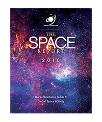
 As smartphones and tablet computers grow ever more capable and popular, hardware and software designers are finding new ways to provide consumers with space-enabled services. Integration of these services into regular consumer devices means that more people are able to reap the benefits of space systems than ever before. The following excerpts contain some of the many examples of space products and services described in The Space Report 2010: The Authoritative Guide to Global Space Activity, published by the Space Foundation in April this year.
Hybrid Wireless Phones
In September 2009, satellite communications company Terrestar announced a new product to be released this year in cooperation with AT&T. The Genus smartphone, a hybrid satellite and terrestrial wireless phone, will enable users to access voice and data services in the United States, Puerto Rico, the U.S. Virgin Islands, and offshore coastal waters using AT&T’s cellular network and TerreStar’s satellite network. By merging the capabilities of satellite and terrestrial networks, the companies will be able to offer coverage in more places and with greater reliability.
Satellite Radio/Wireless Phone Integration
There is also an increasing trend in the integration of satellite radio with smartphones, as exemplified by the XM SkyDock, the first satellite radio dock for the iPhone and iPod touch. The SkyDock acts as a satellite antenna while the iPhone controls the reception and outputs the sound. The product gives users access to all XM channels and enables a variety of features, such as the ability to rewind up to 30 minutes of live satellite radio. SIRIUS XM also released a smartphone application in 2009, enabling subscribers to listen to many of the satellite radio channels via the internet.
GPS Integration Trends
The rapid growth in smartphone applications has naturally included many programs that take advantage of GPS chips built into the phones. In October 2009, Google released its Google Maps Navigation application, which provides free, real-time, turn-by-turn directions on smartphones using Google’s Android software. Google’s move marks the first time a turn-by-turn navigation service has been available for free. Google’s service announcement resulted in a steep decline in the stock price of personal navigation device manufacturer Garmin. As a result, manufacturers of traditional navigation devices are adopting new strategies to differentiate themselves. Part of that strategy involves moving away from standalone hardware devices to development of software applications for smartphones.
The launch of pay-for-service navigation applications for the Apple iPhone by established GPS manufacturers TomTom, Navigon, Garmin, and Trimble strengthens the iPhone’s personal navigation capability. Apple already has numerous navigation applications for the iPhone by companies other than the established GPS equipment providers. According to electronics market research company iSuppli, iPhone navigation users could increase from 2 million in 2009 to 23 million by 2013. Beyond automobile navigation, the highly portable smartphones are being used to help athletes track performance. Applications available for the smartphones can serve as a pocket-sized personal trainer, enabling runners and cyclists to gauge such metrics as the distance traveled, pace, altitude, and calories burned. The potential diversity of niche GPS products, services, and applications provides long-term opportunities for growth and change in the way people work and spend their leisure time.
Geocaching is an outdoor treasure hunt game played worldwide where participants utilize GPS-enabled devices to track down hidden containers, or geocaches. In addition to the game itself, it is now possible to follow an individual’s game results on social networking web sites and to receive geocache directions from iPhones with Groundspeak’s new geocaching application.
PerBlue, a mobile development company, created Parallel Kingdom, another new application for the iPhone. Parallel Kingdom is a mobile role-playing strategy game that uses GPS capabilities to create game play that evolves and progresses via the player’s location in the real world. The game creates a localized Google Map based on the player’s position, enabling the players to virtually attack, chat, and interact with friends and other players in the area.
GPS tracking delivers valuable service to the public transportation sector. The Washington, D.C., Metro system and the San Francisco Muni Metro both use NextBus, a GPS-based passenger information system that finds the specific location of the metro train or bus. Real-time transit information provided by NextBus includes estimated arrival time, delivered to customers via mobile devices such as cell phones. After initial testing in 2007, the NextBus service in Washington was paused to allow for technological upgrades. Metro re-initiated this service in July 2009.
This – and much more – information about the ways people use space technology every day can be found in The Space Report 2010: The Authoritative Guide to Global Space Activity. To order a copy in book, PDF, or CD-ROM format, go to www.TheSpaceReport.org.
This article is part of Space Watch: July 2010 (Volume: 9, Issue: 7).
